Selling Drone Maps Online: A Guide to the Drone Map Market Platform
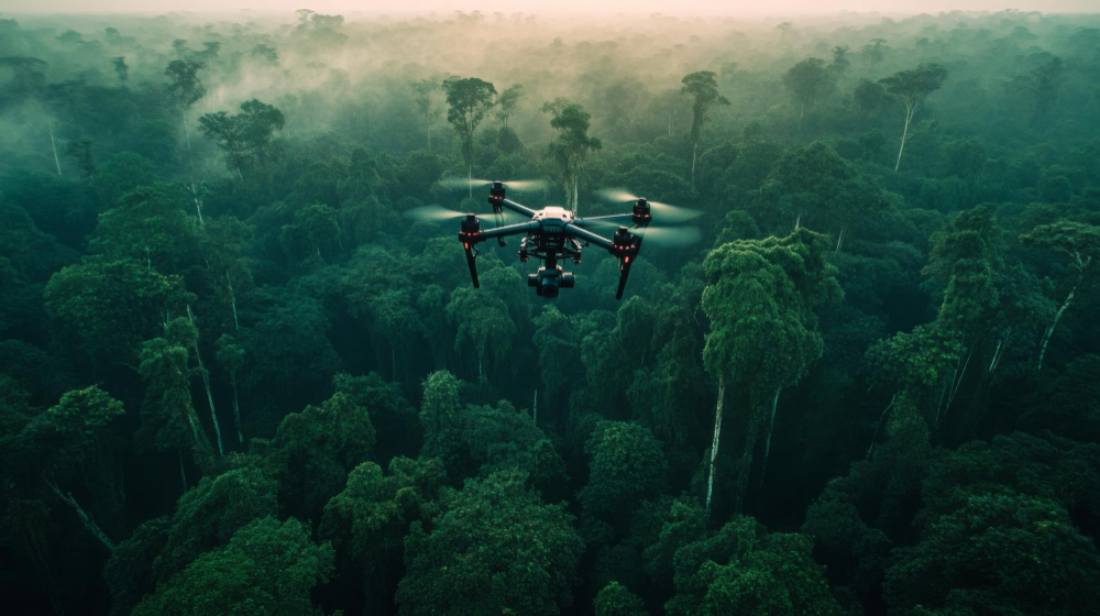
Imagine hovering above a remote mangrove swamp at dawn, your drone’s camera capturing every twist of roots, every patch of vibrant green canopy, and subtle signs of erosion that ground teams could never map in weeks. In under an hour, you’ve generated centimeter-accurate orthomosaics, 3D models, and multispectral vegetation indices that reveal biodiversity hotspots, wildlife corridors, and climate-vulnerable zones. This is the everyday reality of habitat mapping drones – not just flying machines, but powerful tools reshaping conservation, ecology, and environmental management worldwide.
Yet for too many drone pilots and mapping professionals, the story ends there. You invest in high-end sensors, perfect your flights, process terabytes of data… and then? The maps sit on a hard drive while researchers, NGOs, and governments scramble for exactly this kind of hyper-local habitat intelligence. Traditional surveys are slow and expensive. Satellite imagery lacks resolution. Ground teams can’t reach everywhere. The gap between creators of world-class drone data and the buyers who desperately need it has been massive – until now.
Enter the Drone Map Market, the dedicated marketplace developed by GISFY that finally connects habitat mapping drone operators (sellers) with conservation organizations, researchers, urban planners, and disaster-response teams (buyers). Whether you’re a solo drone pilot in Hyderabad flying habitat surveys over the Godavari delta or a global buyer seeking ready-to-use mangrove maps for a restoration project, this platform turns raw geospatial talent into a thriving marketplace. It’s time to stop hoarding data and start monetizing it – or access premium maps without launching a single flight.
What Makes Habitat Mapping Drones So Transformative?
Habitat mapping drones combine lightweight UAVs with advanced payloads – high-resolution RGB cameras, multispectral and hyperspectral sensors, LiDAR, and thermal imaging – to create geo-referenced outputs like orthomosaics, digital surface models (DSMs), digital terrain models (DTMs), contour lines, and NDVI/NDRE vegetation health maps. Unlike traditional methods that take days or weeks and disturb sensitive ecosystems, a single drone flight delivers non-invasive, repeatable data at a fraction of the cost.
Studies on tropical coasts show lightweight drones excel at mapping mangroves, rocky shores, and coral reefs with precision that supports marine protected area (MPA) management. In marshes and wetlands, drone-derived digital surface models track elevation changes relative to sea level with centimeter accuracy. Wildlife teams use them for population counts that are 43–96% more accurate than ground surveys, while restoration ecologists monitor peatland degradation or the spread of invasive species in real time.
The applications are endless and urgent:
-
Biodiversity monitoring: Track habitat fragmentation, species distribution, and ecosystem health.
-
Climate resilience: Map carbon sequestration in forests or erosion in coastal zones.
-
Restoration projects: Before-and-after imagery proves project success to funders.
-
Disaster response: Rapid post-flood or wildfire habitat damage assessments.
-
Policy and planning: Governments and NGOs use detailed maps for protected area demarcation and sustainable development.
The global drone GIS mapping market is exploding – projected to grow from around USD 43 billion in recent estimates toward hundreds of billions by 2035 at CAGRs exceeding 16–22%. Habitat mapping is one of the fastest-growing segments because drones deliver the “mesoscale” sweet spot: detailed enough for science, scalable enough for real-world action.
The Hidden Problem: Data Silos Are Holding Everyone Back
Drone operators pour heart and soul into habitat mapping missions. You calibrate RTK GPS for survey-grade accuracy. You process photogrammetry in Pix4D or DroneDeploy. You deliver stunning deliverables. But marketing them? Finding buyers who understand the value of your 1 cm/pixel mangrove orthomosaic? That’s where most pilots hit a wall. Meanwhile, conservationists waste grant money repeating surveys or settling for low-res satellite data because they can’t quickly source localized drone maps.
This fragmentation hurts everyone. Sellers miss passive income streams. Buyers pay more and wait longer. Ecosystems suffer because critical habitat intelligence isn’t shared fast enough.
Drone Map Market: The GISFY-Built Marketplace That Changes Everything
That’s exactly why GISFY created Drone Map Market – the world’s first purpose-built platform where drone map creators upload and sell high-resolution, geo-referenced habitat maps, and buyers browse, connect directly with sellers, and purchase exactly what they need.
It’s not just another data dump. It’s a true marketplace designed for the drone ecosystem:
-
For Sellers (Drone Operators & Mapping Pros): Upload orthomosaics, 3D models, point clouds, or habitat-specific layers (NDVI for vegetation stress, LiDAR for canopy structure) in minutes. Set your own prices. Reach a global audience of conservation buyers. Manage listings, track performance analytics, and enjoy seamless payments. Start with the Free plan (1 month, limited maps) and upgrade as you scale – Silver ($50/3 months, up to 20 maps + dedicated support), Gold ($75/6 months, unlimited maps + featured placement), or Platinum ($100/year, custom pricing + promotional tools). Early adopters get 20% off with code DRONEMAP.
-
For Buyers (Researchers, NGOs, Governments, Companies): Browse categorized maps for free. Filter by location, resolution, sensor type, or application (habitat mapping, coastal monitoring, biodiversity). Connect directly with the creator for custom requests or updates. Purchase once and own the data – perfect for grant reports, restoration planning, or environmental impact assessments.
The platform makes it effortless. Sellers showcase their best habitat mapping drone work with previews and metadata (flight date, accuracy specs, coverage area). Buyers get instant access to ready-to-use files without negotiating contracts or flying their own missions in restricted areas. Everyone wins – and the planet benefits from faster, better-informed conservation.
Real-world relatability? Picture a drone pilot in Telangana who spent weekends mapping local wetlands. Instead of letting those files gather dust, he uploads them to Drone Map Market. Within weeks, an international NGO working on Ramsar wetland conservation buys the dataset for their baseline study – generating passive income that funds their next habitat mapping drone upgrades. Or a university researcher in Europe searching for coral reef habitat maps finds exactly the high-res orthomosaic she needs from an Indian seller, saving months and thousands of dollars.
Getting Started Is Shockingly Simple – And Free to Begin
Whether you fly habitat mapping drones professionally or need maps for your next conservation project:
-
Visit https://www.dronemapmarket.com/register (sellers) or https://www.dronemapmarket.com/register/buyer (buyers).
-
Sign up in under 60 seconds – no credit card required for the free tier.
-
Sellers: Upload your first habitat map during the 1-month free trial and start connecting with buyers worldwide.
-
Buyers: Start browsing immediately and reach out to sellers for custom habitat mapping drone deliverables.
The platform handles payments, disputes, and even bulk discounts for high-volume buyers. GISFY’s expertise in drone-based survey and monitoring (evident across their geospatial solutions) ensures the marketplace is built by people who actually understand the technology.
Why Habitat Mapping Drones + Drone Map Market Is the Future
The drone GIS mapping industry is booming because habitats are changing faster than ever. Climate shifts, urbanization, and biodiversity loss demand frequent, accurate monitoring. Habitat mapping drones deliver that data at scale. Drone Map Market removes every barrier to monetization and access.
Sellers: Turn every weekend habitat mapping flight into recurring revenue. Build a portfolio that attracts repeat buyers. Scale from hobbyist to full-time geospatial entrepreneur.
Buyers: Stop wasting time and money on redundant surveys. Access verified, high-resolution drone maps from trusted creators across India and beyond. Accelerate your conservation impact.
The window is wide open right now. Early adopters are claiming featured placements and building loyal customer bases. Limited-time discounts are live. The next big habitat restoration project could be funded by the very maps you upload today.
Don’t let your habitat mapping drone data stay grounded. Don’t let your conservation projects wait for slow surveys.
Register free today at Drone Map Market – the GISFY-powered platform where habitat mapping drones meet real buyers and real impact.
Sign up as a seller: https://www.dronemapmarket.com/register
Sign up as a buyer: https://www.dronemapmarket.com/register/buyer
Start uploading. Start browsing. Start changing the world – one habitat map at a time.
