How Drone Data Marketplaces Are Reshaping the Future of Agriculture
Agriculture is rapidly evolving with the adoption of digital technologies. Among the most transformative innovations is crop health monitoring using drones, which allows farmers, agronomists, and agricultural companies to detect plant stress, disease, and nutrient deficiencies long before they become visible to the human eye.
However, while drone technology is advancing quickly, another challenge is emerging in the industry: access to high-quality agricultural drone data. Many organizations need crop monitoring data but lack the resources to conduct drone surveys themselves. At the same time, thousands of drone operators collect valuable agricultural imagery that often remains unused after a project.
This is where Drone Map Market, a platform developed by GISFY, becomes highly relevant. It connects drone data sellers and drone data buyers, enabling the exchange of high-value drone mapping datasets, including agricultural and crop monitoring data.
Understanding Crop Health Monitoring
Crop health monitoring refers to the process of continuously observing crops to assess their condition, growth stage, and overall productivity. Traditionally, this required manual field inspections, which are time-consuming, expensive, and often inaccurate for large farms.
Drone technology has changed this completely.
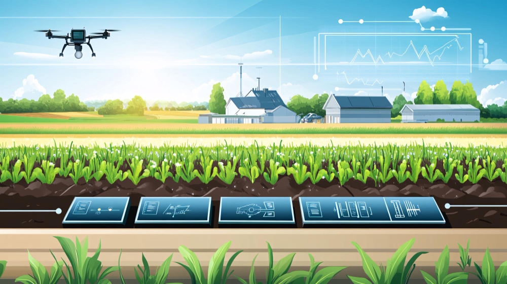
Agricultural drones equipped with specialized sensors can collect high-resolution aerial imagery and generate insights about crop conditions across entire fields in a fraction of the time required by traditional methods. These drones capture data related to plant growth, soil conditions, moisture levels, and vegetation health.
One of the most widely used techniques in crop monitoring is NDVI (Normalized Difference Vegetation Index), which analyzes how plants absorb and reflect light to measure their health and vigor. NDVI maps allow farmers to quickly identify areas of stress, disease, or nutrient deficiency.
By analyzing these maps, farmers and agricultural companies can make precise decisions about irrigation, fertilization, and pest control.
Why Crop Health Monitoring Is Critical for Modern Agriculture
The global agricultural sector faces growing challenges, including climate change, water scarcity, rising production costs, and the need to feed an increasing population.
Crop health monitoring using drones helps address these challenges by providing data-driven insights for precision agriculture.
Key benefits include:
Early Detection of Crop Stress
Drone sensors can detect plant stress caused by pests, disease, or nutrient deficiency before it becomes visible in the field. Early detection allows farmers to take targeted corrective action.
Precision Irrigation Management
Drone imagery can identify dry or over-irrigated areas in fields, allowing farmers to adjust irrigation schedules and reduce water waste.
Reduced Chemical Usage
Instead of spraying pesticides or fertilizers across entire fields, farmers can apply treatments only where necessary, lowering costs and environmental impact.
Yield Prediction and Crop Planning
Drone data helps agronomists estimate crop growth patterns and forecast yields more accurately.
These advantages make drone-based crop monitoring an essential component of modern precision agriculture systems.
The Growing Demand for Agricultural Drone Data
As more agricultural organizations adopt data-driven farming, the demand for drone imagery and agricultural mapping data is increasing.
Companies across several sectors rely on crop health monitoring data, including:
- Agritech companies
- Agricultural research institutions
- Insurance companies
- Food supply chain companies
- Government agriculture departments
- Environmental monitoring agencies
However, collecting this data independently is often expensive and time-consuming.
Organizations must hire drone pilots, conduct surveys, process imagery, and analyze the data, often repeating the same process for different locations.
At the same time, drone operators around the world are generating enormous volumes of mapping data that remain unused after the initial project. According to discussions within the UAV mapping community, large amounts of drone datasets often remain archived even though organizations actively need such data for analysis and planning.
This gap between data availability and data accessibility has created the need for a centralized platform where drone datasets can be exchanged.
Introducing Drone Map Market
Drone Map Market is a digital marketplace designed specifically for drone mapping data.
Developed by GISFY, a company specializing in geospatial technologies and digital solutions, the platform enables users to buy and sell drone datasets across industries, including agriculture, infrastructure, disaster management, and environmental monitoring.
The concept is simple but powerful.
Instead of collecting drone data every time a new analysis is required, organizations can access datasets that have already been captured and processed by drone professionals.
Drone Map Market creates an ecosystem where:
Drone Data Sellers
Drone pilots, UAV survey companies, and mapping professionals can upload and monetize their datasets, including agricultural imagery, orthomosaics, and crop monitoring maps.
Drone Data Buyers
Agriculture companies, researchers, and analysts can access high-quality drone imagery and datasets for analysis without conducting new field surveys.
This marketplace model helps unlock the true value of drone data.
How the Drone Map Market Supports Crop Health Monitoring
For agriculture professionals, access to reliable drone datasets can significantly improve crop monitoring and decision-making.
Drone Map Market can provide access to datasets such as:
- Multispectral crop imagery
- NDVI vegetation maps
- Agricultural orthomosaics
- Field health monitoring datasets
- Irrigation and soil moisture maps
These datasets allow analysts and agronomists to study crop conditions across large geographic areas without deploying their own drone missions.
For example:
An agricultural analytics company might need crop monitoring data from multiple regions to develop predictive models.
Instead of conducting dozens of drone surveys, they can access ready-to-use datasets through Drone Map Market.
Similarly, researchers studying crop diseases or environmental impacts can access historical drone imagery to understand changes over time.
Why Drone Data Marketplaces Are the Future of Agriculture Intelligence
The drone industry is increasingly shifting from hardware-driven innovation to data-driven value creation.
While drones capture the data, the real value lies in the insights derived from that data.
Drone data marketplaces like Drone Map Market represent the next step in this evolution.
They allow:
- Drone operators to monetize their mapping data beyond the original project
- Organizations to access high-quality geospatial data quickly
- Researchers to analyze agricultural patterns across multiple regions
- Agritech companies to build smarter crop monitoring solutions
In essence, these platforms transform drone imagery from a one-time deliverable into a reusable digital asset.
Why Drone Professionals and Agriculture Companies Should Join the Drone Map Market
Whether you are collecting drone data or analyzing agricultural datasets, joining a specialized drone data marketplace can unlock new opportunities.
For Drone Data Sellers
- Monetize crop monitoring datasets
- Reach a global market of agriculture and geospatial professionals
- Showcase your drone mapping capabilities
For Drone Data Buyers
- Access crop monitoring data without conducting expensive surveys
- Discover datasets from multiple agricultural regions
- Accelerate research, analytics, and decision-making
By bringing both sides of the ecosystem together, Drone Map Market creates a collaborative platform for the global drone mapping industry.
The Future of Crop Health Monitoring
Crop health monitoring will continue to evolve with advances in drones, artificial intelligence, and geospatial analytics.
Future systems will combine drone imagery with machine learning models to automatically detect diseases, predict yields, and recommend optimal farming strategies.
However, none of these innovations can function effectively without access to high-quality drone data.
Platforms like Drone Map Market play a crucial role in enabling this data ecosystem by connecting drone data creators with organizations that need actionable insights.
